Water Woes XX-Are We All Wet?
- Mark L. Johnson
- Mar 12, 2023
- 2 min read

Snowpack (Aqua) Western US (1/22/23)-NASA Satellite Image
Tortolita Alliance (TA) has been proactively keeping the community informed of water supply status, forecasts and issues. We hit a milestone with this 20th issue of Water Woes!
Recent significant rain and snow in the western United States has provided hope for drought relief but is it just a short-term blip?
Here we examine current water supply status and projections.
Colorado River Status
The Central Arizona Project (CAP) now has a Colorado River Conditions Dashboard which provides the latest Colorado River system reservoirs levels, reservoir level projections and precipitation projections. Here is a summary as of 2/27/23:
Lake Powell-23% full (elevation 3,521')
Lake Mead-29% full (elevation 1,047')
USBR-February 24-month Study (End of Year 2024 Projections)-Lake Mead Elevation
Worst Case-elevation 1,002.5'
Most Probable-elevation 1,017.6'
Best Case-1,047.6'
Shortage Conditions (see Shortage Tier Table 1 below)
Current-Tier 2
Projected 2024 (Most Probable)-Tier 3

Aridification Test
In Water Woes VI-Aridification aridification was defined as the process whereby a region becomes increasingly drier (arid) over a long period of time. Many scientists believe that because the soil is so dry in the upper Colorado River Basin (20+ years of drought), that spring runoff from snowmelt will get absorbed into the ground and not much water will make it to the Colorado River.
The current average snowpack in the Colorado River Basin above Lake Powell is 18.71" Snow Water Equivalent (SWE). This is 129% of the March 12 historical average. Good news but will all that water make it to the Colorado River?
This year will be the big test! All the scientists, water experts and water suppliers will be watching closely over the next few months.
Cutbacks Beyond The Tiers
The Colorado River water supply situation is so bad, the United States Bureau of Reclamation (USBR) requested the Basin States to come up with a plan make more drastic cuts beyond the tiers referenced above.
As usual they could not come to complete agreement. Six of the seven Basin States presented the Consensus-Based Modeling Alternative, which includes reductions based on evaporation and seepage losses along the Colorado River. California did not agree and came up with the California Alternative which is based on historical Law of the River requirements.
The graphic below demonstrates the difference between the alternatives. They reach the same overall reductions (2-4 million acre-feet/year) but under the California Plan, Arizona makes the largest cuts.
USBR will soon take these Alternatives under consideration and make some historic and important decisions. Stay tuned!

Arizona Drought Conditions Improve

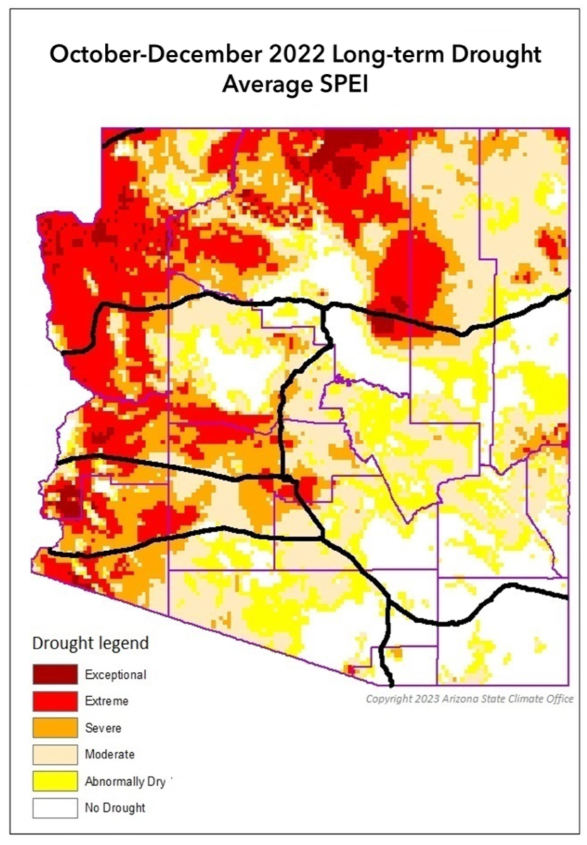
TA attended the Local Drought Impact Group (LDIG) Meeting via Microsoft Teams on 3/8/23. The recent rain and snow has improved the short-term drought situation with 68% of Arizona in the "white"---no-drought. See graphic (left).

However, ADRWR's long-term drought projections are not as rosy with only a small portion of the state in the white. See graphic (right).
